2024 GIS Day & Geography Awareness Week
Exploring geography deepens our understanding of the planet. The Brown community is invited to celebrate GIS Day & Geography Awareness Week with special activities grounded in building our awareness of place.
2024 GIS Day & Geography Awareness Week
Exploring geography deepens our understanding of the planet. The Brown community is invited to celebrate GIS Day & Geography Awareness Week with special activities grounded in building our awareness of place.
About the banner image: Zebra graze at the Maasai Mara National Reserve in Kenya. In the background is a map of the network of global protected areas. Courtesy of colloquium speaker Professor Amy Frazier, University of California, Santa Barbara.
The Institute at Brown for Environment & Society, Spatial Structures in the Social Sciences, the Department of Earth, Environmental and Planetary Sciences, and the Brown University Library celebrated GIS Day and Geography Awareness Week with workshops, activities, and events celebrating geography and our relationship with our environment.
Photo Contest
More than two dozen students submitted photos in three categories. Here are the winners!
Category 1: Natural Landscapes and/or Geology

1st place winner: Shivangi Singh | Parvati Valley, Himachal Pradesh, India | God Rays embracing Himalayan Range
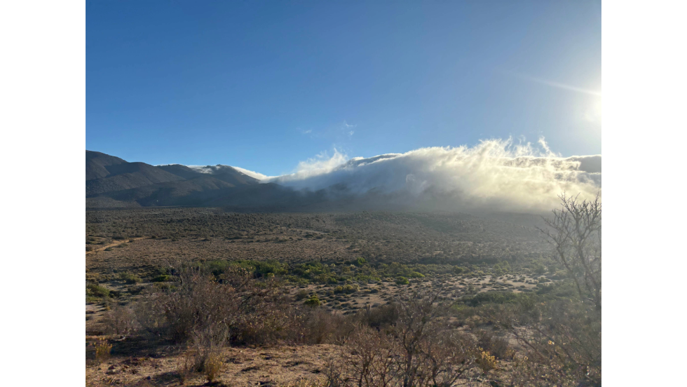
2nd place winner: Montana Stone | Bosque de Fray Jorge, Chile | The Pacific coastal fog coming down the mountains in Bosque de Fray Jorge Chile
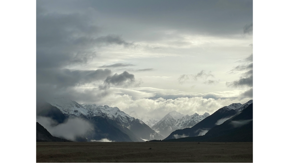
3rd place winner: Shaochi Chuang | Fiordland National Park, NZ | The snow capped mountains of the largest national park in New Zealand.
Category 2: Urban Landscapes

1st place winner: Shivangi Singh | Providence, Rhode Island | River of lights flowing at the twilight's glow
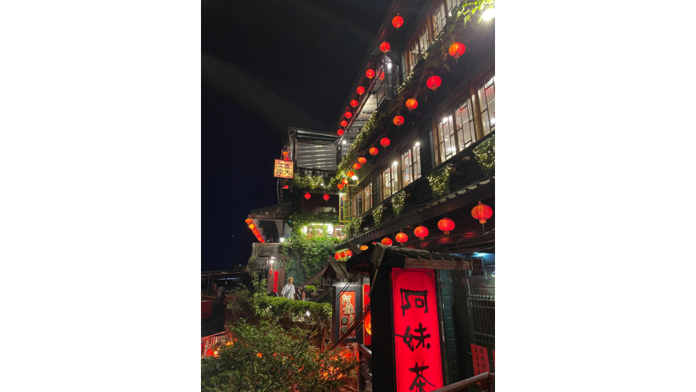
2nd place winner: Shaochi Chuang | Jiufen, Taiwan | The Jiufen A-Mei Teahouse, famous for its likeness to the teahouse of the movie Spirited Away.
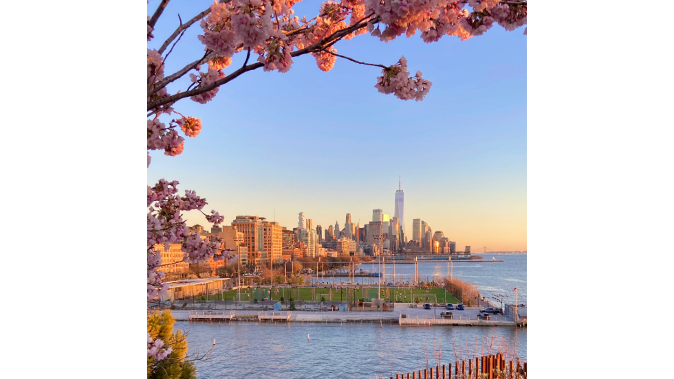
3rd place winner: Alex Tully | Little Island, New York City | Cherry blossom sunset on a warm spring evening in New York City.
Category 3: People and/or Culture
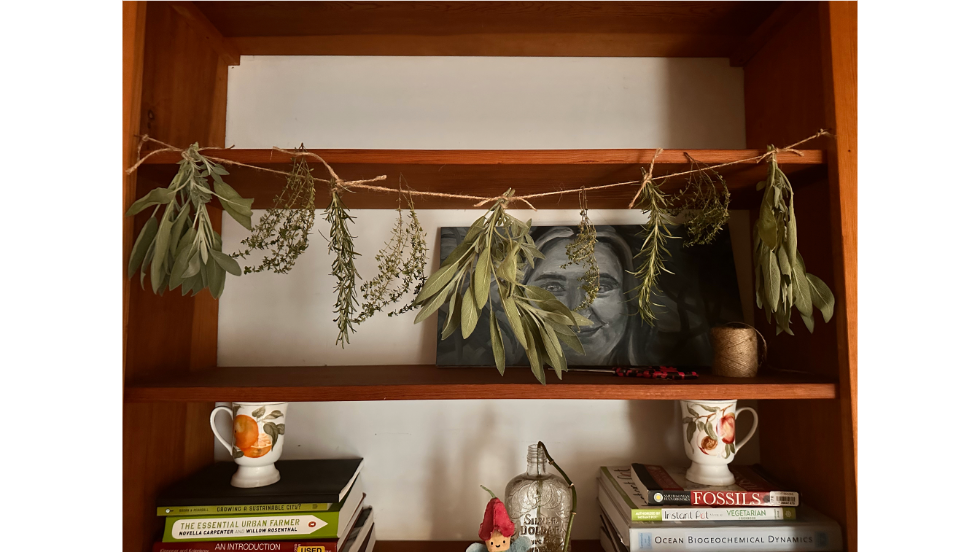
1st place winner: Quinn Cowing | Providence, RI | Herbs hang off a piece of twine draped along a shelf with paintings, books, and crafts in the background.
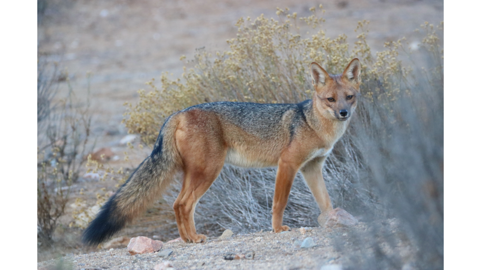
2nd place winner: Montana Stone | Bosque de Fray Jorge, Chile | An Andean Zorro approaches the field team to investigate their investigations of his habitat.
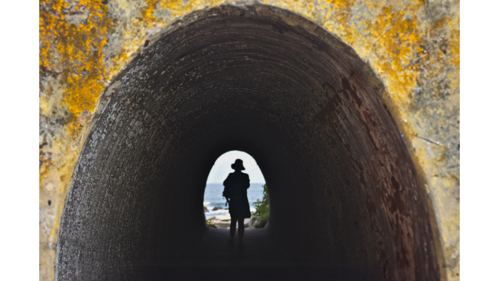
3rd place winner: Sarah Dugal | Newport, RI | I took this photo at home over the summer, and I like how the image visually draws you to follow the woman down her path to the ocean; I feel that this symbolizes the central importance of the ocean to identity of the Rhode Island community.
GIS Day: Wednesday, November 20: Photo Scavenger Hunt & Workshops
Day-long event
Go Photo Scavenger Hunt!
Ready to take a walk? This high-tech scavenger hunt will be on campus OR wherever you are! Grab your GPS-enabled smartphones to join finding the “caches.”
Players use GPS devices (or their phones) to find the points, use clues to navigate to the “caches,” and finally take a picture of it. The team or individual who finishes earliest gets a GIS Day swag! See instructions here.
Across campus
10 am -11 am
Mapping OpenStreetMap Data with Python (hybrid event)
Get ready to learn the basics of OSM data and sharpen your Python powers! Access the notebook and repository on GitHub.
This event is offered in a hybrid format. Our physical venue can accommodate 20 participants, so registration is required for in-person attendance. For remote participation, you can access the Zoom link.
Earth Lab, 85 Waterman St, Providence
11 am - Noon
#BrownGISday2024 HOT Mapathon (hybrid event)
Help mapping disaster-affected areas and provide vital data for relief efforts. Whether you're experienced with GIS or new to mapping, your participation will directly support aid to vulnerable communities. All skill levels welcome!. The leader gets a water bottle and canvas tote bag!!
This event is offered in a hybrid format. Our physical venue can accommodate 20 participants, so registration is required for in-person attendance. For remote participation, you can access the Zoom link.
Earth Lab, 85 Waterman St, Providence
Noon - 12:30 pm
SciLi Map Tour
This short tour of the Sciences Library map collection showcases our 20th century topographic, geologic, street, and thematic maps from the US and around the world. Learn how to read a topographic map, how to find the digital versions of the maps in our collection, and discover the GIS and data services offered at GeoData@SciLi.
Sciences Library (SciLi), 201 Thayer Street, 11th Floor
Limited to 20 participants. Registration required.
1 - 2 pm
Google Earth Engine
Google Earth Engine is a planetary-scale platform for satellite imagery and related datasets, and is freely available for academic and personal use. This workshop will focus on using Google Earth Engine with Jupyter/Colab Notebooks. We will introduce basic concepts and demonstrate how to access and display satellite imagery, calculate indices, and export data to Google Drive.
Limited to 20 participants. Registration required.
Earth Lab, 85 Waterman St, Providence
2 - 3 pm
Social Explorer and PolicyMap
In this workshop, we’ll introduce the Social Explorer and PolicyMap, two web-based census mapping databases available through the library. No GIS experience? No problem! These applications make it easy for anyone to visualize and map census data.
Limited to 20 participants. Registration required.
Earth Lab, 85 Waterman St, Providence
Thursday, November 21: Geography Awareness Week Colloquium
4pm
DEEPS Colloquium | From data to decisions: a geographic approach for co-designing and implementing ‘30x30’ conservation goals (hybrid event)
The world is at a tipping point for biodiversity, with over a million species facing extinction and climate change reshaping life on Earth. The Kunming-Montreal Global Biodiversity Framework offers a path forward, recommending that 30% of land and water be protected by 2030 (known as ‘30x30).
 Yet, while agreements like these are a crucial step, they often fall short in practice. Successfully implementing conservation targets requires collaboration between scientists and decision makers to generate actionable insights that will guide policy.
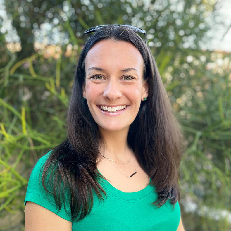
In this talk, Amy Frazier, professor of geography at the University of California, Santa Barbara, will share how her team is partnering with countries around the world to implement conservation projects that protect the planet. She will also explore how a co-design approach helps us navigate challenges in using geographic methods for effective conservation decision-making.
This event is offered in a hybrid format. Registration is requested for in-person attendance. For remote participation, attend via Zoom.
Amy Frazier is a Professor of Geography and the Jack and Laura Dangermond Endowed Chair of Conservation Science at the University of California, Santa Barbara. Her research integrates remote sensing, GIS, and landscape ecology to study global environmental change, specifically to prevent the loss of biodiversity and ecosystem services. She and her team use a variety of field- and lab-based methods, including drones, machine learning, and statistics, to harness massive amounts of biological and environmental data, produce valuable tools and knowledge from those data that can inform conservation decisions, and integrate that knowledge into policy-making pipelines.
MacMillan 115, Reception to follow in the GeoChem Admin Suite
Friday, November 22 | Workshops & Colloquim
11 am - 12 pm
Social Explorer and PolicyMap Workshop
In this workshop, we’ll introduce the Social Explorer and PolicyMap– two web-based census mapping databases available through the library. No GIS experience? No problem!These applications make it easy for anyone to visualize and map census data.
Limited to 20 participants. Registration required.
Earth Lab, 85 Waterman St, Providence
Noon - 1pm
S4 Colloquium: Using Modern GIS for Stakeholder Engagement
With Jay Metzger, Senior GIS Analyst Project Manager, VHB
Drawing on his extensive experience, including his work as GIS Manager at the Rhode Island Department of Health, Metzger will highlight how GIS can be applied in project management, public health, and more.
This event is part of Brown’s S4 ongoing colloquia series, fostering conversations around spatial topics in the social sciences. Whether you're an experienced GIS user or just getting started, this talk offers valuable insights into how spatial tools enhance decision-making and collaboration.
Mencoff Hall, 68 Waterman Street, Room 205
1-2pm
Mapping OpenStreetMap Data with Python (hybrid event)
Get ready to learn the basics of OSM data and sharpen your Python powers! Access the notebook and repository on GitHub.
This event is offered in a hybrid format. Our physical venue can accommodate 20 participants, so registration is required for in-person attendance. For remote participation, you can access the Zoom link.
Earth Lab, 85 Waterman St, Providence