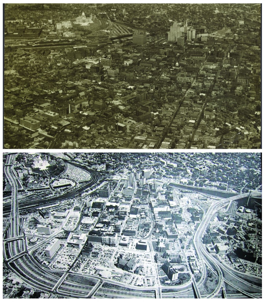
Few of these manufacturing sites operate today, but the legacies of their historical activities likely live on in the local environment—whether city-dwellers know it or not. Sociologist Scott Frickel and his team are on a quest to catalogue not only active industrial sites, but also those whose doors closed during the second half of the 20th century, in an effort to shed light on the chemical contaminants that may pose risks to the modern inhabitants of the Ocean State.
.JPG)
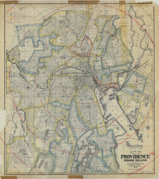
Graduate student Thomas Marlow has spent his time in the Frickel lab poring over dusty manufacturing directories, combining their data with Geographic Information Systems technology, and refining computer code in order to craft an extensive database of every industrial facility that operated in the state of Rhode Island between 1953 and the present.
With the help of computer scientists from Brown's Data Science Practice, he created an algorithm that not only geocodes locations, but is also automated and has the potential to perform similar work on directories from other states.
"Our database is unique in its geographic specificity and the historical time period that it covers," says Frickel. "No one else is working with site-specific data for every single facility that has operated over a 65-year period across an entire state."
"What we can do with that level of comprehensive data is to really understand, in very spatially and temporally-specific ways, how environmental inequality changes."
Data and demographics
By combining their detailed industrial site data with historical census information, Frickel and his team can explore how neighborhoods change in relation to both active manufacturing sites and inactive, historical ones—what the team labels "relic" or "legacy" industrial sites.
For instance, between 1980 and 2010, an analysis of Frickel's data reveals specific environmental inequalities in the old manufacturing core of Rhode Island: both African Americans and Hispanics tend to live in neighborhoods with more active and relic industrial sites than whites.
And Frickel has also found something more novel—that environmental inequality looks different for some affected populations than it does for others.
For example, since 1980, African Americans in the Providence area have tended to live in neighborhoods close to both active and relic industrial sites. Hispanics, on the other hand, have tended to live in areas that are rife mostly with legacy sites—where there is much less current economic activity and much more densely concentrated historic contamination.
"This suggests that Africans Americans are living in more economically vibrant neighborhoods than Hispanics," says Frickel. "On the one hand, they're living closer to currently-active industrial activities, so there are the risks that go along with proximity; but those kinds of places are also the kinds of places that regulators tend to pay more attention to."
Frickel's research is innovative in its attempt to answer open questions regarding where environmental contaminants exist, what types of contamination persist, whether or how people are exposed to such contaminants, and which populations are most at-risk.
"Group by group, we can think about historical changes in active and legacy industrial activity," says Frickel. "We can really begin to tease apart the nature of the inequality that exists, and how that inequality is changing for different social groups over time."
Health and hazards
But Frickel and his team want to do more than understand the nature of environmental inequality in Providence—they want to put their database to work addressing it. Indeed, the lab is now working with regulatory agencies to connect its analytical potential with tangible public health benefits on the ground.
Historically, such agencies have tended to focus mainly on large, active industrial sites—not the older and often smaller hazardous sites that Frickel and his lab are uncovering.
"We don't know a lot about the contamination on these sites. They come and go, other things get built on top of them, and cities chug along. Nobody's paying attention," he explains. "Our work really shines a spotlight on a gaping hole in regulatory policy and regulatory knowledge and practice."
One way that Frickel and his team have introduced their work to the regulatory sphere is through a recent collaboration with the Rhode Island Departments of Health and Environmental Management.
Together with postdoc Jennifer Guelfo, database creator Marlow determined which public water sources would be at greatest risk for contamination by an emerging class of industrial chemicals called per- and polyfluoroalkyl substances, or PFAS.
These dangerous chemicals, which could once be found in everything from non-stick coatings to fire extinguishing materials, were used at Rhode Island manufacturing sites from the mid- to late-20th century and are still extremely persistent in water systems.
Using the team's recommendations as a guide, the Rhode Island agencies tested the most at-risk public wells and groundwater recharge stations for contamination.
To Frickel, this partnership illustrates the practical power of his team's database.
"We've already had an instance where this knowledge has been used at regulatory agencies to help them do their job," he says.
Dissemination and citizen science
Analyzing local drinking water isn't the only way that Frickel's work has been trickling down into the local community. He and his team are also hard at work making all of their data accessible to the public via an interactive website that is slated to launch by late 2018.
By exploring maps and other visual graphics, Providence citizens will be able to drill down into their very own neighborhoods to see how the places they call home have changed over the decades.
"My hope is that we will be partnering with other institutions in the city to get our information out into neighborhoods," says Frickel. "To use the website and the geospatial data as a starting point for conversations with neighborhood groups and a seedbed for collaborative citizen-science types of projects."
Frickel and his team hope to engage in talks with Providence Mayor Jorge Elorza, aiming to employ his office's neighborhood liaisons to help generate an interest in what Frickel calls "public environmental history."
"I really see the data that we're bringing to bear on this as a platform," he says. "Other kinds of crowdsourced knowledge can be brought onto the website to build it up, and it becomes a real community resource that way."
And it isn't just adults that Frickel and his team hope to reach. Last summer, the Providence Children's Museum piloted an exhibit that featured the team's industrial site data spread out over a huge, painted canvas map of its very own neighborhood: the old Jewelry District.
"They laid it out for kids to run around on, look at, and ask questions about," says Frickel. "The larger hope is that our data will get incorporated into a permanent exhibit at the museum so it will inform not just the little kids that visit the museum, but the parents and families that bring them there."
Indeed, Frickel's work has implications for all of the city's populations: adult residents who are concerned about persistent chemicals in their neighborhoods, policymakers who need to know about potential sources of environmental contaminants, and children whose own adulthoods may be marked by emerging contaminants as climate change and increased flooding expose hazards that lurk in abandoned, riverside factories.
"When we think about the impacts of a changing climate, legacy contaminants are going to factor in in important ways," says Frickel. "I think that's another area where we'll be able to help provide a base of knowledge that will help policymakers when they get around to trying to mitigate its effects."
But all of this groundbreaking work starts with the data.
"As a social scientist, I'm really interested in what cities are, how they work, and how they change in relation to the natural environment," Frickel concludes. "This database is going to allow us to do that at a fine grain of historical detail that nobody has ever attempted before. That's very exciting to me."