Institute at Brown for Environment and Society
2025 GIS Day & Geography Awareness Week
Exploring geography deepens our understanding of the planet. The Brown community is invited to celebrate GIS Day & Geography Awareness Week with special activities grounded in building our awareness of place.
2025 GIS Day & Geography Awareness Week
Exploring geography deepens our understanding of the planet. The Brown community is invited to celebrate GIS Day & Geography Awareness Week with special activities grounded in building our awareness of place.
Photo contest
Community members submitted over two dozen photos in three categories. Here are the winners!
Category 1: Natural Landscapes / Geography
1
of
3
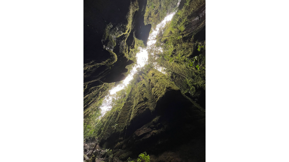
1st place winner: Camila Cuellar | El Peñón, Santander, Colombia | Vertical rock walls in a jungle canyon, covered in moss and ferns

2
of
3
2nd place winner: Maximiliano Garcia | Southern Icefields, Patagonia, Chile | The slow death of the glacial giants

3
of
3
3rd place winner: Karsen Chiminelli | Arches National Park, Utah | Looking up through Double Arch on the EEPS Spring Break Field Trip 2025
Category 2: Urban Landscapes
1
of
3
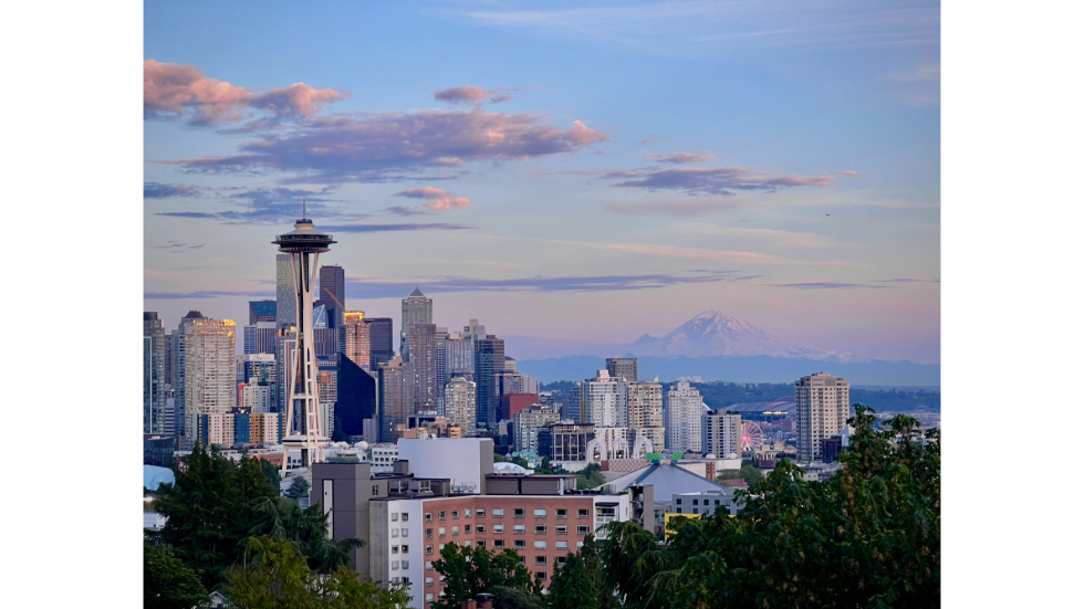
1st place winner: Karsen Chiminelli | Kerry Park, Seattle, Washington | Sunset overlooking Mount Rainier and the Seattle Space Needle

2
of
3
2nd place winner: Montana Stone | Manhattan, New York | A foggy day in New York City, between the Manhattan Bridge and the Brooklyn Bridge

3
of
3
3rd place winner: Markus Joerg | Munich, Germany | A train rushes by the dilapidated Schlachthofviertel (Slaughter House Quarter) on the outskirts of Munich
Category 3: People / Culture

1
of
3
1st place winner: Ange Yeung | Locarno Beach, Vancouver, Canada | Beachgoers at sunset against the backdrop of the Burrard Inlet and Cypress Mountain
2
of
3
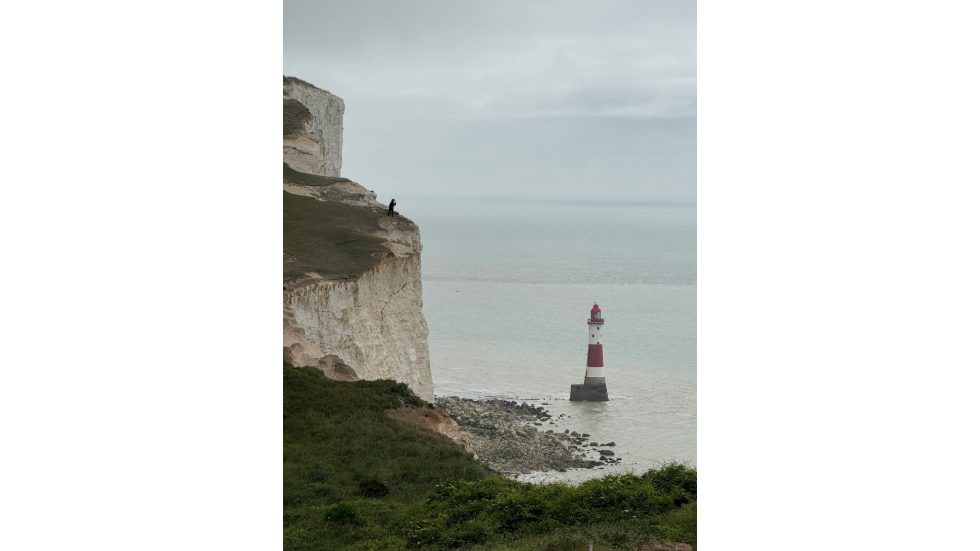
2nd place winner: Shaochi Chuang | Beachy Head Lighthouse, East Sussex, England | Woman admiring a lighthouse from a cliff

3
of
3
3rd place winner: Meredith Whitlock | Newport, Rhode Island | Two friends and the foggy infinity at the edge of the sea
Schedule of events
Space is limited to 20 participants for certain events. Sign up through each event listing to reserve your spot!
This day-long, hands-on workshop provides a thorough introduction to geographic information systems (GIS) using the free and open source software QGIS.
Spatial AI: Innovations and Applications | Artificial Intelligence (AI) is reshaping the ways we visualize, analyze, and interact with spatial data, transforming geographic analysis, mapping, and decision-making. In this talk, you’ll explore how Generative AI at scale opens new frontiers in social science and enables novel approaches to universal questions such as human flourishing.
This short tour of the Sciences Library map collection showcases our 20th century topographic, geologic, street, and thematic maps from the US and around the world.
Help map disaster-affected areas and provide vital data for relief efforts.
Interested in where GIS skills can take you beyond the classroom? Join us for a panel featuring professionals who have built diverse careers in transportation, utilities, government, and environmental planning. Moderated by Garth Hoxsie Quinn, the panel will include brief introductions followed by an open Q&A, giving students the chance to learn firsthand how GIS expertise translates into meaningful career paths.
Learn how remote sensing data plays a crucial role in mapping, using electromagnetic spectrum, resolutions for detailed observations, and methods for classifying extracted data using GeoAI algorithms
Get ready to learn the basics of OSM data and sharpen your Python powers!
This short tour of the Sciences Library map collection showcase 20th century topographic, geologic, street, and thematic maps from the US and around the world.
AI Across the Curriculum, GeoAI Across the Globe: Building Programs & Advancing Land-Change Research
Kick off the final day of Geography Awareness week with a series of rapid-fire presentations showcasing how GIS is being applied across public and private sectors. In this fast-paced session, speakers will deliver concise overviews of their projects, giving the audience a broad look at the many ways spatial data and mapping inform real-world decisions.
Sanchez, Senior Project Manager and GIS Manager at BETA Group, Inc., will discuss "The Convergence of AI and GIS: A Framework for Data-Driven Asset Management."
Brown’s Geography Awareness Week is hosted by:
Organizing Partner: The Rhode Island Geographic Information System (RIGIS) - A consortium promoting the interests of Rhode Island’s geospatial community
Top banner image photo credit: Previous contest winner Kaiyuan Wang in the Urban Landscapes category. Sunset over the expanding suburb at Lianyungang city, urbanization slowly encroaching into farmland.